
Freeburg trustees met with representatives from the Missouri Department of Natural Resources (DNR) and state and national park services on March 7 to discuss progress toward the conversion of the old …
This item is available in full to subscribers.
We have recently launched a new and improved website. To continue reading, you will need to either log into your subscriber account, or purchase a new subscription.
If you are a current print subscriber, you can set up a free website account by clicking here.
Otherwise, click here to view your options for subscribing.
Please log in to continue |
|
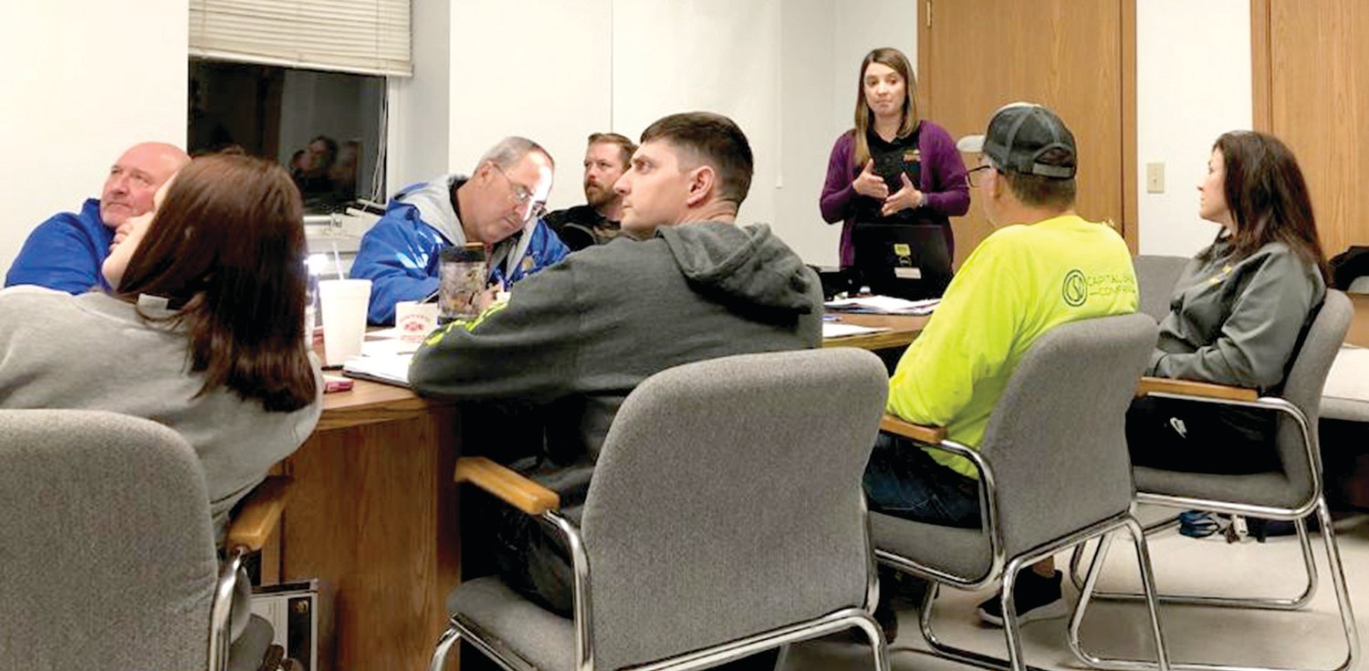
Freeburg trustees met with representatives from the Missouri Department of Natural Resources (DNR) and state and national park services on March 7 to discuss progress toward the conversion of the old Rock Island Railway into a bicycling and hiking trail. Park officials say Freeburg is “well-positioned” as a trailhead location.
Melanie Robinson-Smith of Missouri State Parks shared with the board an update on where they are with trail development, the funding process, and community development.
The project has been going on for many years with its first interim use agreement in 2012, and the first five-mile section was opened the same year.
The Rock Island Spur was opened in 2016, and in December 2021, they took possession of 144 miles of the rail corridor to form a “great big loop trail.”
Right-of-way on the Katy Trail is traditionally 100 feet but Smith said it will be less uniform on the Rock Island because some of the parcels were sold off to others prior to acquisition by the state.
Trustee Glen Haller asked what it means for businesses and homes on top of the railroad tunnel that goes under the village. “So do you own our post office?” Haller asked.
“The right-of-way overlaps us,” she answered. “There could be an existing license, there are quite a few licenses the railroad had issued that run through Freeburg.”
License agreements were carried over from Ameren. The existing license will be honored and they are empowered to issue any additional licenses needed.
“How much land do you need to have a trailhead?” asked Mayor Darryl Haller.
Robinson-Smith acknowledged it was a good question, but there is no good answer. The trailheads vary with anywhere from 20-100 parking spots in different locations.
“We know we will allow bicycles and hiking, but horses – that’s the question of the day – we allow equestrian use on the Katy Trail from the state fairgrounds to Columbia and on the whole Rock Island Spur … some of the communities are interested in equestrian use, some are not,” said Robinson-Smith. “Allowing horses on the trail will be decided by local interest and equestrian use will require more space.”
Trailheads will vary on the route with some being small (20 cars) or even over 100 spaces. On the Katy Trail, most trailheads are positioned approximately 10 miles apart, making Freeburg “well-positioned” as a trailhead location.
Haller suggested the area between Eldon and Belle might be the biggest attraction. She acknowledged the potential with the tunnels and bridges in the area and suggested starting with a 20-car trailhead. On the Katy Trail, she said, several locations had additional parking added as they became an “in-demand” location.
Typically, a trailhead starts with parking, water, and bathrooms. An information depot provides a bench for rest and shade. Panels will have a map of the entire corridor, an area map with local attractions, and a panel for local history, lore, and color, “a great place to tell your story.”
Currently, they are working on bridges. Bridges will have concrete decking with railings on either side, and the concrete will be run out a bit for a transition.
There will be “hundreds and hundreds” of crossings, Robinson-Smith noted. Those crossings will have speed gates slowing bicyclists and pedestrians and alerting them to the crossing. Those speed gates also prevent vehicles and ATVs from getting onto the trail.
Crossings will be marked with the road name and traditional railroad mile markers will dot the trail, enabling stranded or injured hikers and bikers to pinpoint more closely their location if emergency personnel are needed.
Mayor Haller asked in his role as Freeburg fire chief if they would have full access to the trail to respond to emergencies. He was assured they would have keys issued, and park rangers would be dispatched by the Missouri State Highway Patrol if a 911 call is made.
Robinson-Smith next addressed fencing. The Rock Island Corridor has a state statute requiring maintenance of existing fencing. At this point, they do not have staffing or funding for that, but she will know more by the summer.
Adjacent landowners who need fencing will be able to receive the materials free of charge, but installation will be their responsibility. Fences will be placed at a mutually agreed-upon location. Five-strand barbed wire is the usual material, but consideration will be given to other agricultural fencing based on landowner use.
Mayor Haller asked about brush along the trail. Some will be removed but a lot of it will be left as a natural barrier between the trail and landowners. Brush also makes for a more scenic trail with more shade.
At times, it may be more time-efficient to work on fencing from the landowner’s property instead of the right-of-way.
“With the trespass laws, you can’t go on anyone’s property without permission from the landowners, correct?” Trustee Shane Zimmer asked.
“Yes,” Robinson-Smith responded. “Right now our access is from the right-of-way only.”
One thing she said might help with adjacent landowners’ concerns is that overnight use of the trail is prohibited. The trails will be closed after dark. There will be no camping on the right-of-way, and boundaries are clearly marked.
“We don’t allow any overnight lodging, so no camping on the trail,” said Robinson-Smith. “That may be something that the community of Freeburg might look into.”
She added that people may be looking for camping or other places to stay.
Park rangers are getting acquainted with local law enforcement and will be available in case of trouble.
DNR Deputy Director Mike Sutherland discussed funding for the trail. More than $500,000 is available from donations to the Rock Island Endowment Fund after approval by the legislature. A $2.7 million grant from the federal Department of Economic Development will also go toward development of the corridor.
Gov. Mike Parson’s recommendation that $69 million from the American Rescue Plan Act (ARPA) be used for trail funding is waiting on the legislature. If received, that money would have to be spent by 2026, so the trail would see rapid progress. Sutherland cannot provide a timeline for construction or completion.
Hamacher asked for a dollar estimate for development of the whole corridor. Robinson-Smith said it would cost between $80 million and $100 million.
Communities may apply for grants through the Recreational Trails Program (RTP) to fund portions within communities along the trail. Mayor Haller said that Meramec Regional Planning Commission (MRPC) Executive Director Bonnie Prigge had advised him to “wait and see” how it goes this year.
National Parks Service Community Support representative Ashley Newson participated by speakerphone. She works directly with communities like Freeburg. She and nine others in her group have broad skillsets in planning and landscape architecture.
Newson’s team helps get trailhead ideas down on paper and helps communities go after a grant. “We know the pieces that they want to see,” said Newson. “We work on conceptual plans, not construction documents.”
“If you decide to go for a grant, having the National Parks on your application goes a long way,” Robinson-Smith said.
“By the end of June, they should know where the trailheads will be located,” said Sutherland. “Then the design phase will begin and looking at specific locations and deciding about parking lot sizes.”
“I think Freeburg has the potential of being a major destination, because of the bridges and tunnels, Sutherland concluded. “It’s pretty neat.”


